Netarhat: The Beauty and History of Jharkhand’s Queen of Chotanagpur
Published: 11 October 2026
Some places ask you to keep moving. Netarhat asks you to stop and look. A hillside changes colour as the sun drops, distant ridges soften into the evening haze, and the road that brought you here suddenly feels less important than the view in front of you. In Jharkhand’s Latehar district, this hill station offers something quieter than a packed sightseeing circuit: time to notice the landscape.
Known as the “Queen of Chotanagpur,” Netarhat is celebrated for sunrise, sunset and its forested surroundings. But beauty is only half its appeal. Its story also includes a much-loved residential school, traces of the colonial period, and a local legend that has become inseparable from its most famous sunset point. Understanding those layers makes a visit more interesting than simply collecting photographs.
Cover photograph: Ujjawalagrawal2, Wikimedia Commons, CC BY-SA 4.0. Resized and converted to WebP; no AI alteration.
Why Netarhat’s beauty feels different
Netarhat’s attraction is not one monument or one dramatic turn in the road. It is the combination of hills, woodland, open viewpoints and changing light. A broad valley can look sharply defined on a clear day and almost disappear when mist settles in. The same lookout rewards patience because its mood is not fixed.
That is why an unhurried visit works better than a checklist. Leave room for a second look at a viewpoint, a quiet walk on a permitted path, or an evening spent watching the sky rather than rushing to the next stop. Cloud cover can hide the sun completely, but it can also make the landscape unexpectedly atmospheric. A photograph records a moment; a longer stay helps you understand the setting.
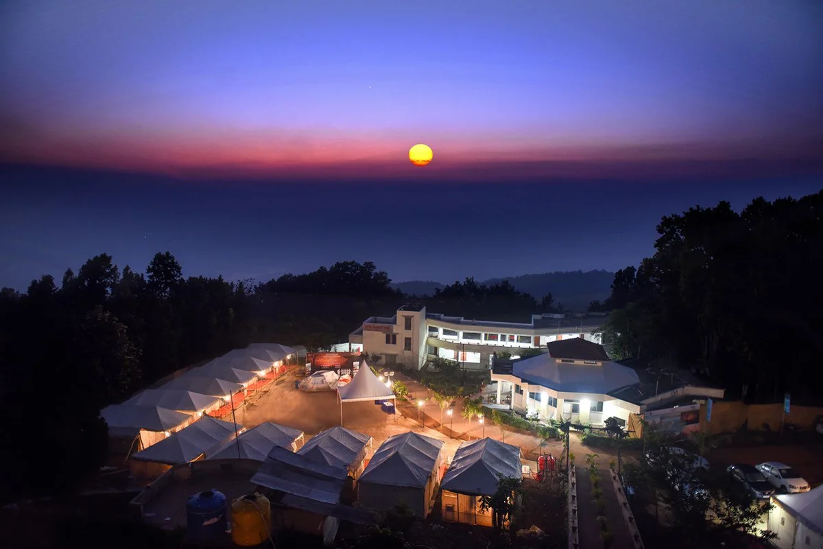
Netarhat is also a lived-in place, not an empty wilderness arranged for tourists. Schools, homes, farms and local businesses are part of the experience. Respect residents’ privacy, ask before photographing people, and avoid entering private land for a better angle. A considerate visitor sees more without making everyday life harder for those who belong here.
Sunrise, sunset and the art of arriving early
Magnolia Point: the famous evening view
Magnolia Point is Netarhat’s best-known sunset destination. Jharkhand’s official tourism information places it roughly 10 kilometres from Netarhat. The attraction is the open view across the hills and the slow transition from afternoon brightness to softer evening colours—not a promise that every visit will produce a perfect orange sun.
Arrive with enough daylight to find the permitted viewing area and settle in without hurrying. Stay behind barriers, keep children close and do not move towards an exposed edge to improve a photograph. Check the return route before dark. The safest place to enjoy a sunset is still the designated viewpoint, even when another ledge looks more dramatic.
Koel View Point and the morning landscape
The state tourism page lists Koel View Point around 3 kilometres from Netarhat. It is another reason not to compress the hills into a single evening outing. Plan a morning around a confirmed local sunrise viewpoint, check the weather and ask your accommodation which access route is currently suitable. Sunrise times change through the year; use the date of your visit rather than a fixed time copied from an old itinerary.
An overnight stay makes this rhythm easier: a sunset on arrival, an early morning view the next day, and time between them to experience the town. It also reduces the pressure to drive unfamiliar hill roads immediately after an evening viewpoint stop.
The history behind the hill station
A place with a past beyond its tourist nickname
“Queen of Chotanagpur” is a tourism epithet, not a complete history. Netarhat belongs to the wider Latehar landscape, whose district history includes forest communities and regional traditions long predating modern tourism. The district administration itself notes that parts of the region’s early history are preserved through legends and traditions. That is a reason to be careful about neat origin stories, not to turn every story into a proven event.
Popular explanations of Netarhat’s name vary. This article does not treat the phrase “Nature’s Heart,” or any other attractive explanation, as an established linguistic origin. A memorable slogan and a documented place-name history are different things.
Colonial-era traces: what the official account says
The Jharkhand Chief Minister’s official tourism page describes Netarhat Dam as having supplied water to the region since the British Raj. It lists the dam approximately 2 kilometres from the main bus stand. This is a specific example of an older feature that survives in present-day visitor descriptions; it does not mean that every building in Netarhat is colonial or that the region’s history began with British visitors.
When exploring heritage, look for information boards and verified accounts rather than relying on a building’s appearance alone. A sloping roof or an old-fashioned façade can suggest a period, but it cannot establish a construction date by itself.
Netarhat Residential School: a documented chapter from 1954
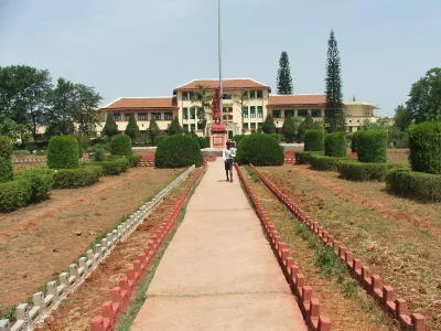
One of Netarhat’s most significant historical landmarks is Netarhat Awasiya Vidyalaya, or Netarhat Residential School. Its own account gives a precise founding date: 15 November 1954. This belongs to the period after Indian independence, not to the British Raj.
According to the school’s official history, educationist Frederick Gordon Pearce developed the scheme, which received the Bihar government’s general approval in 1952. The school opened in 1954 with Charles Napier as its first principal and an initial batch of 60 students on a six-year course. These details provide a firmer historical foundation than the loosely repeated stories that often surround hill stations.
Pearce’s stated vision was to offer high-quality education to talented students irrespective of social class or their parents’ financial resources. The school’s official account describes his involvement in choosing the location, planning infrastructure, selecting staff and shaping administration. Netarhat’s educational reputation is therefore part of its identity, not merely another sightseeing stop.
The Latehar district tourism page describes the school’s greenery, gardens and distinctive red-tiled roof. Its architecture may evoke an older style, but the institution’s founding date remains 1954. If you hope to see the campus, request permission and check visitor rules first. It is a functioning school: classes, student privacy and security take priority over tourism.
The Magnolia story: local legend, not a verified biography
The official Jharkhand tourism account retells a tragic story associated with Magnolia Point: a young British woman named Magnolia fell in love with a local tribal shepherd, faced opposition to the relationship, and died by suicide. The account says a plaque at the viewpoint narrates the story.
Visitors should understand it as a local legend retold in tourism material. The sources consulted for this article do not establish the people’s identities or a precise date through independently verified historical records. A story being printed on a plaque is not the same as an archival biography.
The legend explains some of the emotional associations visitors bring to the viewpoint, but it should not turn a tragedy into a romantic ideal. The landscape can be appreciated without sensationalising the story or treating a community as a decorative part of it.
Waterfalls and woodland beyond the viewpoints
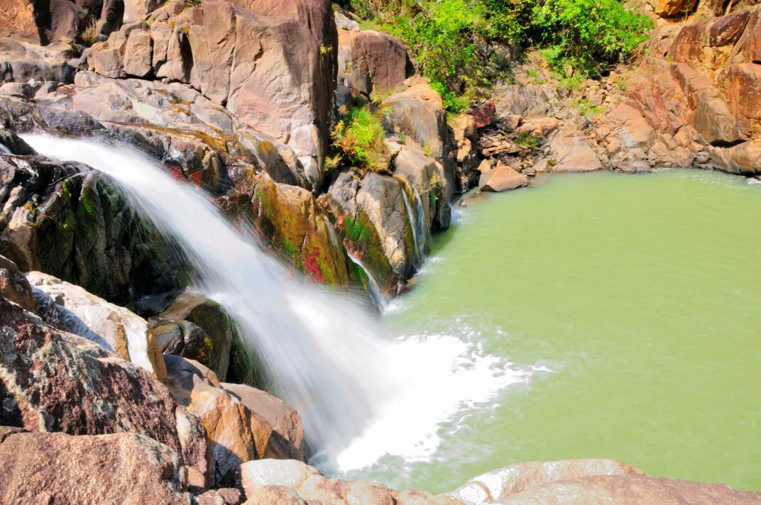
Netarhat’s surroundings offer more than sky and ridgelines. Jharkhand’s official tourism page lists Upper Ghaghri Falls approximately 4 kilometres away and Lower Ghaghri Falls approximately 10 kilometres away. These figures are orientation estimates, not guarantees of the distance from your hotel or of road and walking access on a particular day.
Waterfalls change with the season. Rain can increase the flow, but it can also make paths slippery and access unsafe. Check with local authorities or your accommodation before setting out, especially during or after heavy rain. Do not enter water, climb wet rocks or cross a closure simply because an older guide describes the spot as accessible.
Lodh Falls, described by the state tourism page as Jharkhand’s highest waterfall, is listed around 60 kilometres from Netarhat. Treat it as a separate excursion, not a quick stop next to the town. Confirm the current route, daylight requirements and access conditions before adding it to an already full day.
Planning a thoughtful visit from Ranchi
Jharkhand’s tourism information gives an approximate road distance of 145 kilometres from Ranchi to Netarhat. Your actual journey depends on the starting address, route, roadworks, weather and stops. Check a current map before departure and build in extra daylight rather than treating a quoted travel time as guaranteed.
For a simple overnight plan, travel in daylight, check into your accommodation, and visit an accessible sunset viewpoint without rushing. Keep the next morning for sunrise and one additional local stop, such as a permitted walk or a waterfall that is confirmed open. Return with a comfortable daylight margin. This is a suggested pace, not a timed package or a promise of access.
- Check weather and access: clouds can obscure views, winter mornings can be cold, and rain can change road and trail conditions.
- Carry practical essentials: drinking water, a layer for cool mornings, suitable walking shoes, a charged phone and offline navigation.
- Plan respectfully: confirm accommodation, school permissions and viewpoint access; do not assume every place is open to visitors at all times.
- Leave no trace: take litter back, avoid loud music near quiet viewpoints and do not feed or disturb wildlife.
If you are considering a self-drive trip, use Drigo’s Ranchi to Netarhat car-rental guide for booking considerations and browse live Ranchi cars for the actual vehicle and date-specific quote. Confirm the authorised driver, kilometre allowance, fuel policy, deposit and return terms before paying. Address delivery in Ranchi carries pickup and drop charges; confirm those separately. This article does not advertise a fixed rental rate or free delivery.
Questions travellers often ask
What is Netarhat famous for?
Its hill-station scenery, sunrise and sunset viewpoints, nearby waterfalls and Netarhat Residential School. The appeal is best experienced at an unhurried pace rather than through a long list of stops.
Is Magnolia’s story established history?
It is retold by an official tourism page and associated with a plaque at Magnolia Point, but the sources consulted here do not independently establish the story as a documented biography. We label it as a local legend.
When was Netarhat Residential School founded?
Its official history says it opened on 15 November 1954, after the Bihar government approved the scheme in 1952.
Are these real photographs of Netarhat?
Yes. The cover and article photographs come from Wikimedia Commons file records identifying Netarhat or its surroundings. The school image is archival; the waterfall source does not name the individual fall. None of the images was AI-generated, and the credits below identify the original sources.
A place to remember slowly
Netarhat’s beauty is easy to photograph and harder to reduce to a single frame. Its hills invite you to watch the light; its school offers a documented story of educational ambition; its legends ask for thoughtful interpretation. Visit for the views, but leave with an appreciation of the place beyond them. That is what makes a return journey feel worthwhile.
Sources and photograph credits
Research checked on 11 October 2026. Historical statements above distinguish an institution’s documented history from legends and tourism descriptions. Approximate distances come from the cited official pages, not live navigation. Confirm current access before travelling.
- Government of Jharkhand: Tourism — Netarhat, viewpoints, waterfalls and approximate distances.
- Netarhat Vidyalaya: Origin and History — 1952 approval, 1954 opening, Pearce, Napier and the first student intake.
- Latehar district: Netarhat School — campus description and educational context.
- Chief Minister of Jharkhand: Magnolia Sunset Point — the legend, plaque and tourism account of Netarhat Dam.
- Latehar district: History — regional context; not a founding history of Netarhat itself.
- Cover — Ujjawalagrawal2, original file and provenance, CC BY-SA 4.0.
- An evening view of Prabhat Vihar, Netarhat—not a photograph of Magnolia Point. — Tourism Department, Government of Jharkhand, original file and provenance, CC0 1.0.
- Netarhat Residential School in an archival photograph dated 2005 in the file metadata. It is not a current campus photograph. — Vikash.iitb, original file and provenance, Public domain.
- A waterfall near Netarhat, photographed by Marian kispotta. The source does not identify the individual waterfall, so this image is not labelled as Ghaghri or Lodh Falls. — Marian kispotta, original file and provenance, CC BY-SA 4.0.
All photographs have been resized where needed and converted to WebP, without AI alteration. The two CC BY-SA 4.0 photographs remain available under that license, including these optimised versions. Credits do not imply that any photographer, institution or government department endorses Drigo.